Shop
Honeymoon Tour to Phander Valley, Ghizer & Gilgit Valley
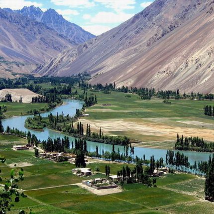
Ghizer District comprises Punial, Gupis, Yasen, Phander, and Ishkoman Valleys. Ghizer is a crossroads between Gilgit and Chitral via Shandur Pass. Gupis has been serving as a junction between Yasin and Phander valley. It is the central place of all valleys like the Phandar & Yasin valleys.
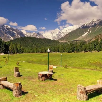
Located between the world’s greatest mountain ranges, namely, the Hindu Kush and the Karakorum, Phander Valley amaze their visitors with its unique landscapes with lakes & rivers.
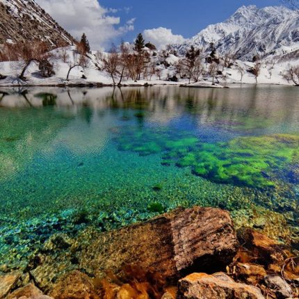
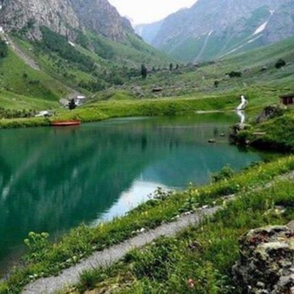
Naltar is a valley near Gilgit city, Naltar is about 54 kilometers from Gilgit and can be reached by jeeps. There are five lakes in the Naltar valley known as Satrangi Lake, Halima Lake, Bodo Lake, Green Lake & Blue Lake at a distance of 13 kilometers.
Honeymoon Tour to Phander, Naran & Hunza Valley
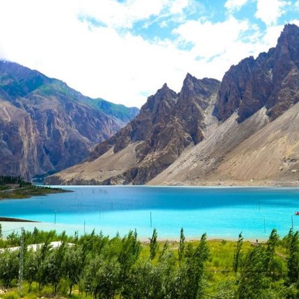
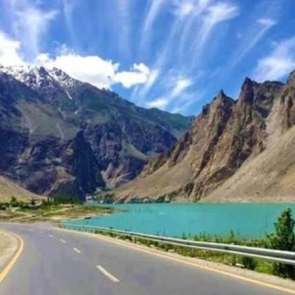
Hunza is a mountainous valley in the Gilgit-Baltistan region of Pakistan. Hunza is situated in the extreme northern part of Pakistan, bordering the Wakhan Corridor of Afghanistan and the Xinjiang region of China.
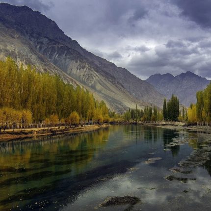
Ghizer District comprises Punial, Gupis, Yasen, Phander, and Ishkoman Valleys. Ghizer is a crossroads between Gilgit and Chitral via Shandur Pass. Gupis has been serving as a junction between Yasin and Phander valley. It is the central place of all valleys like the Phandar & Yasin valleys.
Located between the world’s greatest mountain ranges, namely, the Hindu Kush and the Karakorum, Phander Valley amaze their visitors with its unique landscapes with lakes & rivers.
Naltar is a valley near Gilgit city, Naltar is about 54 kilometers from Gilgit and can be reached by jeeps. There are five lakes in the Naltar valley known as Satrangi Lake, Halima Lake, Bodo Lake, Green Lake & Blue Lake at a distance of 13 kilometers.
Honeymoon Tour to Skardu Deosai & Hunza Valley
Hunza is a mountainous valley in the Gilgit-Baltistan region of Pakistan. Hunza is situated in the extreme northern part of Pakistan, bordering the Wakhan Corridor of Afghanistan and the Xinjiang region of China.
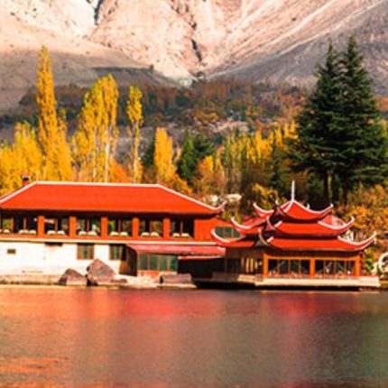
The Deosai National Park is a high-altitude alpine plain and national park in northern Pakistan. It is located largely within Astore District in Gilgit Baltistan. Deosai Plains are situated at an average elevation of 4,114 meters (13,497 ft) above sea level.
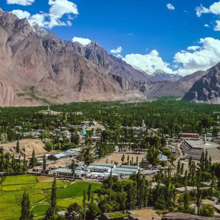
Khaplu also spelled Khapalu, is a town that serves as the administrative capital of the Ghanche District of Gilgit-Baltistan, in northern Pakistan. Lying 103 km east of the town of Skardu, it was the second-largest kingdom in old Baltistan of the Yabgo dynasty.
Trip to Kumrat, Jahaz Banda & Katora Lake
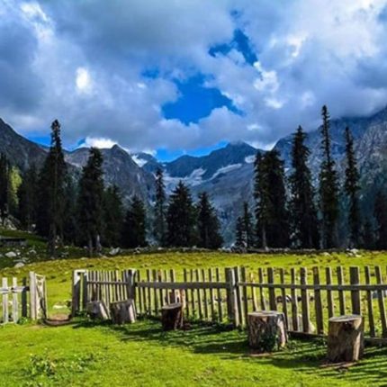
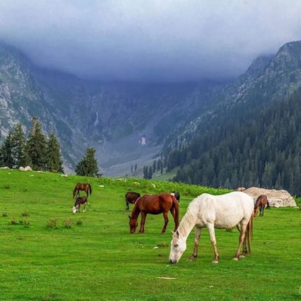
Kumrat is a valley in the Upper Dir district of Khyber Pakhtunkhwa the Province of Pakistan. A picturesque spot for travelers with thick forests, waterfalls & rivers of Kumrat.
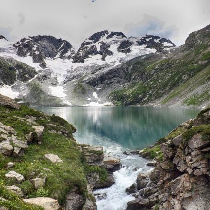
Jahaz Banda, is a large meadow in the upper Kumrat Valley, about 3,100 m above sea level. The region is surrounded by snow-covered mountains, towering trees, and covered by green pastures. one can enjoy the thrilling jeep ride to Jahaz Banda base camp followed by an adventurous hike to Jahaz Banda Top.
Katora Lake is an alpine glacial lake located in Jahaz Banda. The lake is fed by the surrounding melting glacier waters. The word Katora means “bowl” in Pashto. It was named after the lake's resemblance to a bowl shape
Trip to Minimarg, Astore Valley & Rama Meadows
The Astore valley has an area of 5,092 km² and an altitude of 2,600 meters (8,500 ft).
Astore lies about the massive base of Nanga Parbat, the 9th highest peak in the world. To the south of the Nanga Parbat massif lies Rama Valley, which is home to Rama Lake
Minimarg is a village in the Astore Valley of the Gilgit Baltistan. It is situated on the right bank of the Azad Kashmir, Taobao. Accessible from Astore Valley via Domel Top & Domel Pass.
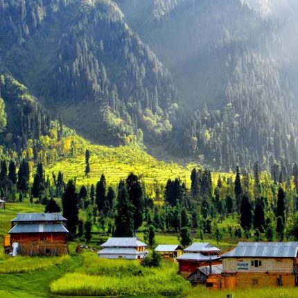
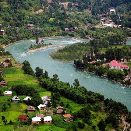
Trip to Neelum Valley Kel & Arang Kel
Neelum District is the northernmost district of Azad Kashmir, Pakistan. Taking up the larger part of the Neelam Valley, the district has a population of 191,000 (as of 2017). It was badly affected by the 2005 Kashmir earthquake.
The Neelum River was known before Partition as Kishan Ganga and was subsequently renamed after the village of Neelam. It flows down from the Gurez Valley in Indian Jammu and Kashmir and roughly follows first a western and then a south-western course until it joins the Jhelum River at Muzaffarabad. The valley is a thickly wooded[citation needed] region with an elevation ranging between 4,000 feet (1,200 m) and 7,500 feet (2,300 m), the mountain peaks on either side reaching 17,000 feet (5,200 m). Neelum Valley is 144 kilometers (89 mi) long.
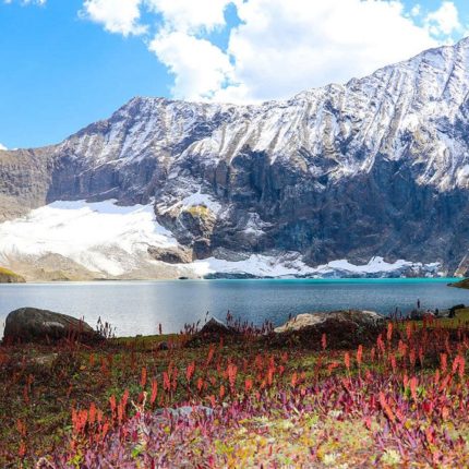
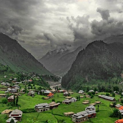
Trip to Ratti Gali Lake & Neelum Valley
Neelum District is the northernmost district of Azad Kashmir, Pakistan. Taking up the larger part of the Neelam Valley, the district has a population of 191,000 (as of 2017). It was badly affected by the 2005 Kashmir earthquake.
The Neelum River was known before Partition as Kishan Ganga and was subsequently renamed after the village of Neelam. It flows down from the Gurez Valley in Indian Jammu and Kashmir and roughly follows first a western and then a south-western course until it joins the Jhelum River at Muzaffarabad. The valley is a thickly wooded[citation needed] region with an elevation ranging between 4,000 feet (1,200 m) and 7,500 feet (2,300 m), the mountain peaks on either side reaching 17,000 feet (5,200 m). Neelum Valley is 144 kilometers (89 mi) long.
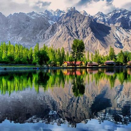
Trip to Skardu, Deosai and Khaplu
The Deosai National Park is a high-altitude alpine plain and national park in northern Pakistan. It is located largely within Astore District in Gilgit Baltistan. Deosai Plains are situated at an average elevation of 4,114 meters (13,497 ft) above sea level.
Khaplu also spelled Khapalu, is a town that serves as the administrative capital of the Ghanche District of Gilgit-Baltistan, in northern Pakistan. Lying 103 km east of the town of Skardu, it was the second-largest kingdom in old Baltistan of the Yabgo dynasty.
Trip to Swat, Kalam & Malam Jabba
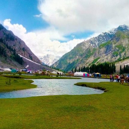
Swat District is a district in the Malakand Division of Khyber Pakhtunkhwa province in Pakistan. Swat is renowned for its outstanding natural beauty.
Kalam is a valley located at a distance of 99 kilometers from Mingora in the northern upper reaches of Swat valley along the bank of Swat River in Khyber Pakhtunkhwa province of Pakistan.
Mahogany Lake is a lake located in the upper Usho Valley at a distance of about 40 km from Kalam, Swat District, Khyber Pakhtunkhwa province of Pakistan. The lake is accessible by a four-wheel-drive vehicle and is often utilized for fishing and boating.